The agriculture remote sensing allows you to measure and analyse data. Combine them with Visual’s power.
1. Measure
Humidity and temperature of soil and atmosphere in real time on your mobile phone.
2. Analyze
A simple control panel to view the agroclimatic conditions of your growing areas with precision.
3. Measure
Actions like irrigation optimization weather forecast and characterize phenology with maximum efficiency.

Optimize risks
Thanks to the agriculture remote sensing you will be able to know accurately the humity and apply the exact water quantity in each crop. Therefore, you will improve your products quality, the profitability of the exploitations will improve and also you will keep the water as a natural resource. It’s unveliable!
Sensors located at all time
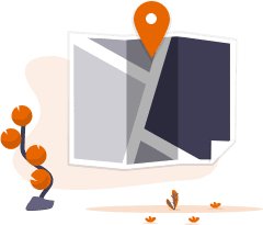
A precise interactive map where is easy to know the precise location of the sensors in each plot. Do not worry thinking about where the sensors are located we do that work for you.


Instant information
Be able to know what is happening in your crops in real time and make decisions at the moment. Receive alerts from your remote sensors and set up news to have everything in control.
Visual sensor is a service that collects data from Visual sensors, from more than 2000 public stations, from virtual stations anywhere in the world and from expert weather forecasting services. All on one platform and intuitively accessible from the map.
*Visual Sensor also allows to connect with third-party sensors.
If you want to know more about our services, ¡contact with us!

